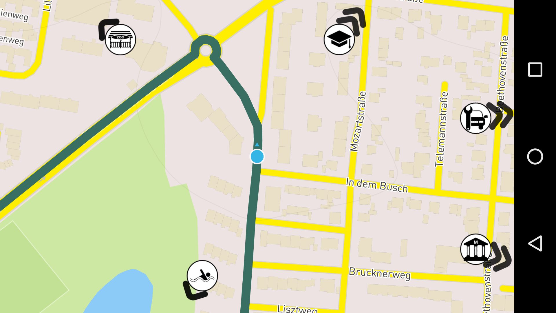
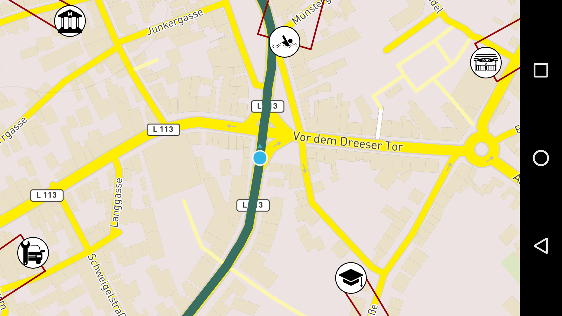
The use of car navigation systems is a convenient way to reach a destination. However, users often become device-focused and develop only a reduced understanding of their environment. Common navigation systems focus on the route and its instructions. Landmarks are seldom used in navigation systems, yet they are important elements to support spatial orientation during wayfinding tasks. One way to convey information about landmarks is to display them in a navigation system’s map interface. Due to limited screen sizes and map scales, landmarks are mostly outside the mapped area. This work develops and tests two types of visualizations of off-screen landmarks to support spatial orientation while navigating. Implemented as Android Application.
Implemented two different visualizations of off-screen landmarks
#### Wedges:Simulating and playing car drives from gpx waypoint files.
- Update Mapbox Android SDK
- Provide UI to select route
- Improve settings menu
MIT License
Copyright (c) [2016] [Daniel Schumacher]
Permission is hereby granted, free of charge, to any person obtaining a copy of this software and associated documentation files (the "Software"), to deal in the Software without restriction, including without limitation the rights to use, copy, modify, merge, publish, distribute, sublicense, and/or sell copies of the Software, and to permit persons to whom the Software is furnished to do so, subject to the following conditions:
The above copyright notice and this permission notice shall be included in all copies or substantial portions of the Software.
THE SOFTWARE IS PROVIDED "AS IS", WITHOUT WARRANTY OF ANY KIND, EXPRESS OR IMPLIED, INCLUDING BUT NOT LIMITED TO THE WARRANTIES OF MERCHANTABILITY, FITNESS FOR A PARTICULAR PURPOSE AND NONINFRINGEMENT. IN NO EVENT SHALL THE AUTHORS OR COPYRIGHT HOLDERS BE LIABLE FOR ANY CLAIM, DAMAGES OR OTHER LIABILITY, WHETHER IN AN ACTION OF CONTRACT, TORT OR OTHERWISE, ARISING FROM, OUT OF OR IN CONNECTION WITH THE SOFTWARE OR THE USE OR OTHER DEALINGS IN THE SOFTWARE.

