Skip to content
New issue

Have a question about this project? Sign up for a free GitHub account to open an issue and contact its maintainers and the community.

By clicking “Sign up for GitHub”, you agree to our terms of service and privacy statement. We’ll occasionally send you account related emails.

Already on GitHub? Sign in to your account

Possible ways to improve the accuracy of GT #35

Closed
qiaozhijian opened this issue Sep 8, 2022 · 6 comments
Closed

Possible ways to improve the accuracy of GT #35

qiaozhijian opened this issue Sep 8, 2022 · 6 comments

Comments

@qiaozhijian
Copy link

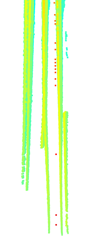
I accumulate the 3D lane GT using pose provided by origin waymo dataset. I find there is a serious blur of accumulated 3D submap in the segment(segment-9568394837328971633_466_365_486_365_with_camera_labels).
Screenshot from 2022-09-08 14-49-59
Let's look at the first small section of this submap. There are even some outliers such as red points.
Screenshot from 2022-09-08 14-44-38
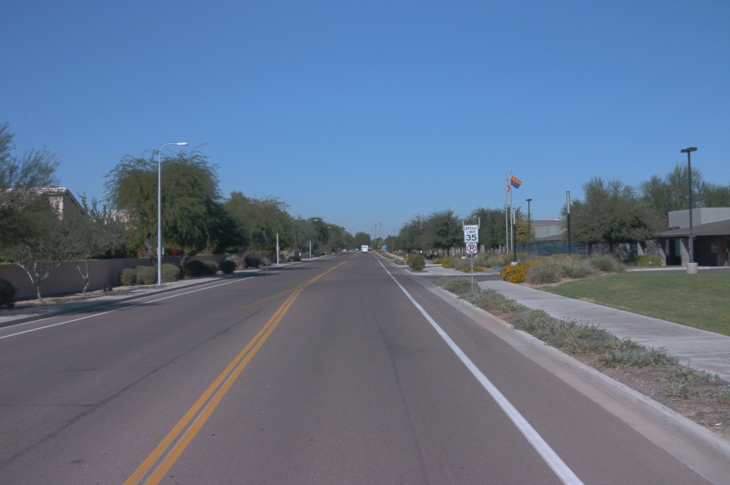
For easy understanding, the corresponding images are as follows
Screenshot from 2022-09-08 14-44-05

I think there are two ways to improve the quality of map:
First, use only the closer lane points. For example, 20m

Screenshot from 2022-09-08 14-43-48
Second, fit the 3D lanes again in the submap and project them to every frame.

@qiaozhijian qiaozhijian changed the title Possible ways to improve the accuracy of truth values Possible ways to improve the accuracy of GT Sep 8, 2022
@qiaozhijian
Copy link
Author

Code is as follows.

import os
import json
import tensorflow._api.v2.compat.v1 as tf
import numpy as np
import open3d as o3d
from waymo_open_dataset import dataset_pb2 as open_dataset
import cv2

tf.enable_eager_execution()


class OpenLane(object):

    def __init__(self, dataset_dir):
        self.dataset_dir = dataset_dir

    def fetch_data(self, segment, timestamp):
        gt_json = os.path.join(self.dataset_dir, 'lane3d_1000/training', segment, '{}.json'.format(timestamp))
        with open(gt_json, 'r') as fp:
            gt_dict = json.load(fp)

        image_path = os.path.join(self.dataset_dir, 'images', gt_dict['file_path'])
        img = cv2.imread(image_path)

        lane_all = []
        for lane in gt_dict['lane_lines']:
            xyz = np.asarray(lane['xyz']).reshape(3, -1).T
            lane_all.append(xyz)
        lane_points = np.vstack(lane_all)

        return img, lane_points


def visualize_pcd(points):
    pcd = o3d.geometry.PointCloud()
    pcd.points = o3d.utility.Vector3dVector(points)

    o3d.visualization.draw_geometries([pcd])


def lanemap(filename, openLane_dir):
    dataset = tf.data.TFRecordDataset(filename, compression_type='')
    segment = filename.split('/')[-1].replace('.tfrecord', '')
    openLane = OpenLane(openLane_dir)

    world_frame = None
    lane_map = []
    for cnt, data in enumerate(dataset):
        frame = open_dataset.Frame()
        frame.ParseFromString(bytearray(data.numpy()))
        timestamp = "{:<018}".format(frame.timestamp_micros)  # openlane seems to use 18 digit

        image0 = next(c for c in frame.images if c.name == open_dataset.CameraName.FRONT)
        calibration = next(cc for cc in frame.context.camera_calibrations if cc.name == image0.name)
        ex0 = np.array(calibration.extrinsic.transform, dtype=np.float32).reshape(4, 4)
        vechile_pose = np.array(image0.pose.transform, dtype=np.float32).reshape(4, 4)
        cam0_pose = vechile_pose @ ex0

        img, lane_points_c = openLane.fetch_data(segment, timestamp)
        # lane_points_c = lane_points_c[lane_points_c[:,0]<20]

        if world_frame is None:
            world_frame = cam0_pose
        T_wc = np.linalg.inv(world_frame) @ cam0_pose
        lane_points_w = lane_points_c @ T_wc[:3, :3] + T_wc[:3, 3].reshape(1, 3)
        # visualize_pcd(lane_points_c)
        lane_map.append(lane_points_w)

    lane_map = np.vstack(lane_map)
    visualize_pcd(lane_map)


if __name__ == '__main__':
    # Replace this path with your own tfrecords.

    filename = '/media/qzj/Extreme SSD/datasets/waymo/raw_data/segment-9568394837328971633_466_365_486_365_with_camera_labels.tfrecord'
    openLane_dir = '/media/qzj/Extreme SSD/datasets/OpenLane/'
    lanemap(filename, openLane_dir)


@RicardLee
Copy link
Contributor

@qiaozhijian thanks for your effort and advice on this dataset. We are trying to reproduce the problem and fix it. In fact, 3D lanes filter by projection, consistent with the your second way, have been applied. Due to the interpolation operation, some outlier points error may be caused.

@RicardLee
Copy link
Contributor

RicardLee commented Sep 20, 2022

Refer to the issue 31, it may causes this problem. In new openlane, this problem will be effectively improved.

@qiaozhijian
Copy link
Author

Refer to the issue 31, it may causes this problem. In new openlane, this problem will be effectively improved.

Thanks, Ricard Lee. I agree with you that coordinate system may cause this problem. But better yet, check whether this problem is solved using new openlane referring to my code. I know producing GT, especially for far lane points, is very difficult and of a lot work. So, feel free!

@RicardLee
Copy link
Contributor

RicardLee commented Sep 21, 2022

@qiaozhijian Thansk , before release, we will check this problem again.

@qiaozhijian
Copy link
Author

I'm sorry that I had a mistake in my code.
lane_points_w = lane_points_c @ T_wc[:3, :3] + T_wc[:3, 3].reshape(1, 3)
should be
lane_points_w = lane_points_c @ T_wc[:3, :3].T + T_wc[:3, 3].reshape(1, 3)

Sign up for free to join this conversation on GitHub. Already have an account? Sign in to comment
Labels
None yet
Projects
None yet
Development

No branches or pull requests

2 participants