Home
Welcome to the Global Streetscapes dataset wiki!
This documentation outlines how we download and process the data for Global Streetscapes. It also provides a quick start guide for how to start using this dataset.
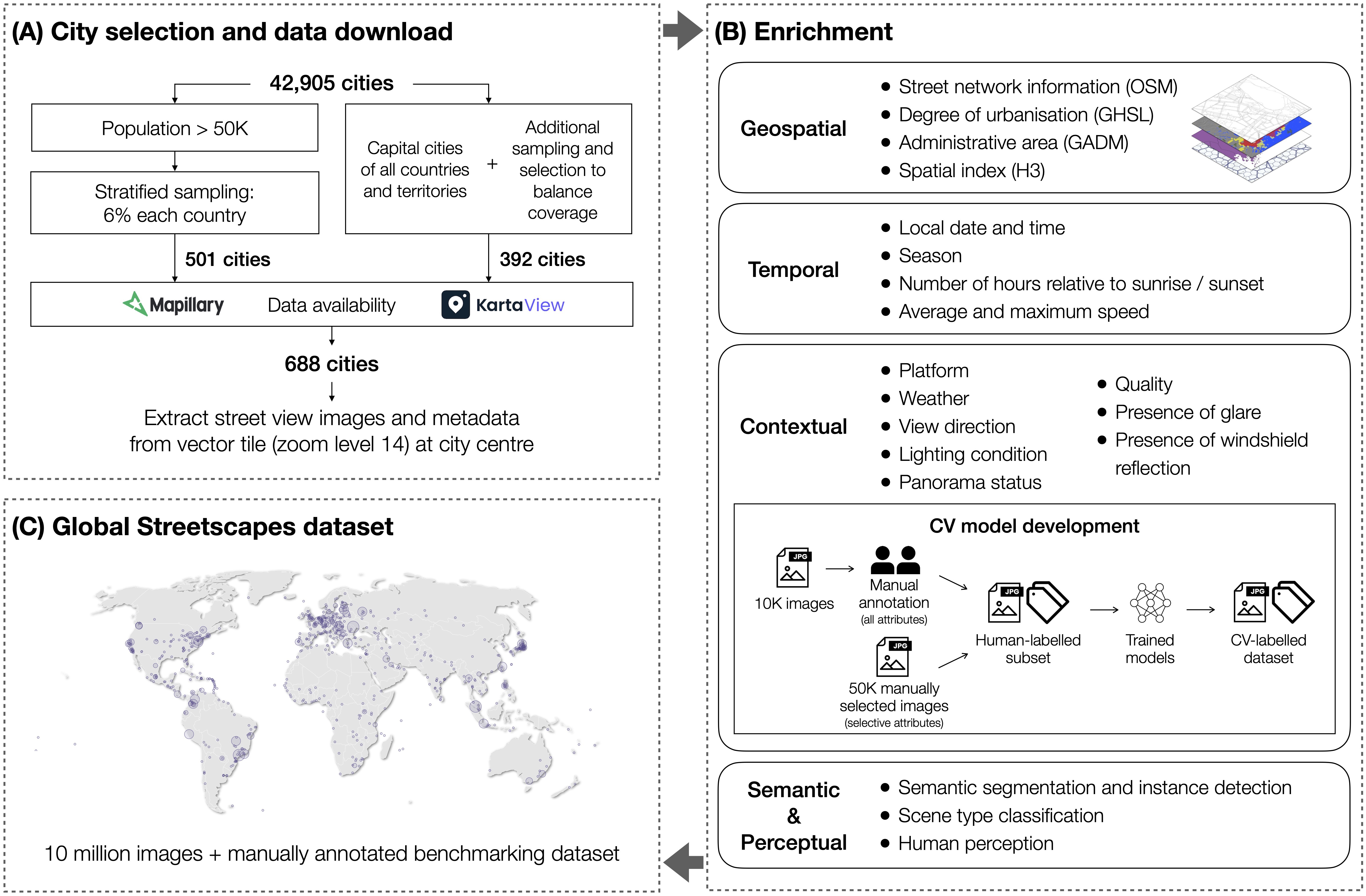 The methodology framework, from city selection and data download (A) to data enrichment (B), to produce the Global Streetscapes dataset (C).
Download the tabular portion (.csv) of the dataset from our data repository.
For the image files (.jpeg), you can run our code to download all, or a subset of them, from Mapillary and KartaView:
- Code: code/download_imgs
- Wiki: 2 - Download images
To reproduce, expand, or update the dataset, it would involve the following processes:
- Download raw metadata (
.csv) from Mapillary/KartaView- Code: code/raw_download
- Wiki: 1 - Download raw data
- Download image files (
.jpeg) from Mapillary/KartaView- Code: code/download_imgs
- Wiki: 2 - Download images
- Enrich metadata with additional geospatial and temporal information
- Code: code/enrichment
- Wiki: 3 - Data enrichment
- Run computer vision models with images to produce contextual, perception, instance segmentation, and place labels
- Code: code/model_training
- Wiki: 4 - Model training
To install requirements for CV (computer vision) related tasks (i.e. code/model_training):
Install Python 3.10.14
pip install -r requirements-cv-linux.txt
Note that some packages might require Linux system.
To install requirements for non-CV related tasks (i.e. code/raw_download, code/download_imgs, code/enrichment):
Install Python 3.10.1
pip install -r requirements-non_cv.txt