Fix Robinson inverse projection#2151
Merged
rouault merged 3 commits intoOSGeo:masterfrom Apr 14, 2020
Merged
Conversation
Member
In test/gie/builtins.gie , look for robin. The syntax should hopefully be obvious from existing cases |
Contributor
Author
|
Thanks |
kbevers
reviewed
Apr 14, 2020
Co-Authored-By: Kristian Evers <kristianevers@gmail.com>
Contributor
Author
|
Ok, I'm not sure how to test invalid values: ^ this doesn't seem to work |
Member
|
Contributor
Author
|
Thanks, fixed now! |
This file contains hidden or bidirectional Unicode text that may be interpreted or compiled differently than what appears below. To review, open the file in an editor that reveals hidden Unicode characters.
Learn more about bidirectional Unicode characters
Sign up for free
to join this conversation on GitHub.
Already have an account?
Sign in to comment
3 participants
Add this suggestion to a batch that can be applied as a single commit.This suggestion is invalid because no changes were made to the code.Suggestions cannot be applied while the pull request is closed.Suggestions cannot be applied while viewing a subset of changes.Only one suggestion per line can be applied in a batch.Add this suggestion to a batch that can be applied as a single commit.Applying suggestions on deleted lines is not supported.You must change the existing code in this line in order to create a valid suggestion.Outdated suggestions cannot be applied.This suggestion has been applied or marked resolved.Suggestions cannot be applied from pending reviews.Suggestions cannot be applied on multi-line comments.Suggestions cannot be applied while the pull request is queued to merge.Suggestion cannot be applied right now. Please check back later.
This PR fixes the Robinson inverse projection so that coordinates outside of the main projection area become invalid.
docs/source/*.rstfor new APIThe issue can be simply illustrated with this:
The first call to invproj should actually return invalid values.
Here is an illustration on before and after, showing the longitudes for the different coordinates (produced with pyproj and matplotlib).
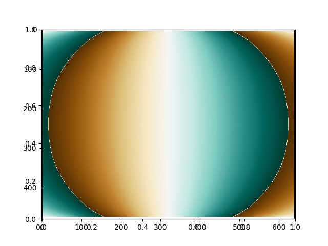
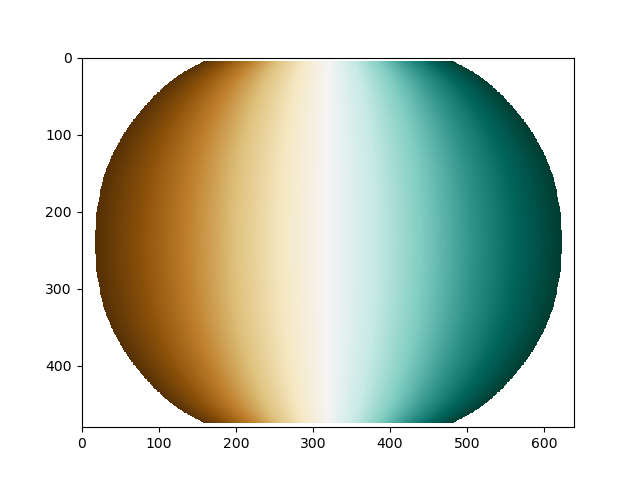
The white areas denote invalid values. As you can see, before this PR, the longitudes were wrapped around the edges of the projection area.
I didn't add any unittest though, because I haven't found the file to add then too. Could give anyone give a hint for that ?