Cutline Images
Exporting an GeoTiff-Image from a Raster Coverage with the Cutline option
<-- 'Index Page for RasterLite2 - Commands'
For the cutline logic, the following 3 images are results after use
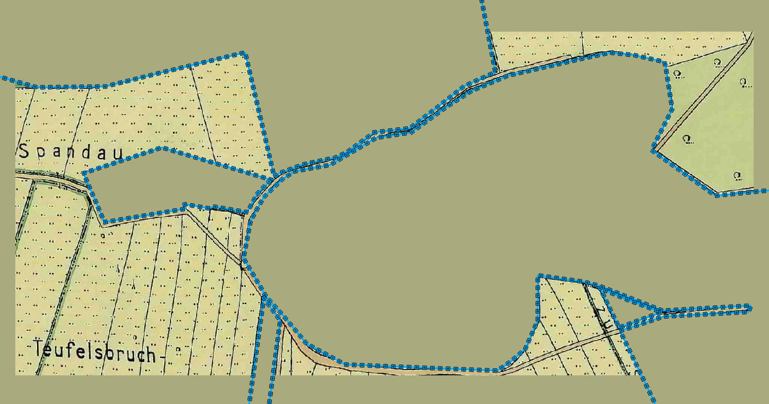
1927 Area of Eiskeller, Berlin-Spandau, Falkensee, Brandenburg
- the cutout portion of the Eiskeller area of the 'Original Image':

1927 Area of Teufelsbruch, Eiskeller, Berlin-Spandau
- shows the cutout portion of the 'Original Image':
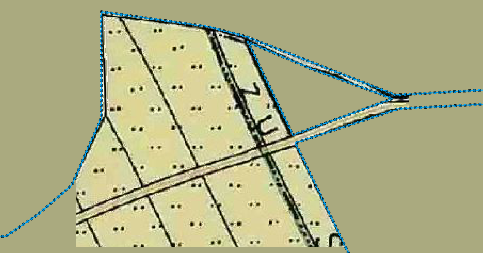
- main POLYGON portion
- which is only connected by a slim path
- the 3 enclaves
- with only the northern portion of the third being shown
- main POLYGON portion
1927 Minimal area for Valgrind tests
- 312 x 231 Pixels
- 193 x 143 Meters (rounded)
Last but not least: Eiskellerweg
- after August 1961, this path was the only connection between Eiskeller and Spandau
- The schoolboy Erwin Schabe who, in September 1961, came home complaining that he'd been sent back by East German border guards while on his way to school along a narrow path that was surrounded by East German territory.
- The result can be seen in the photo below, which was taken somewhere along this path
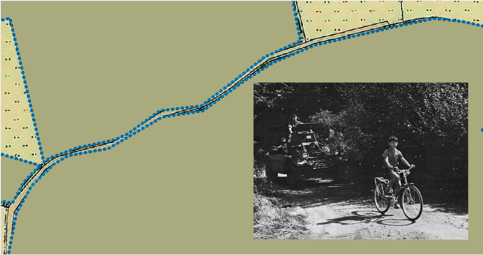
[An original article of the day from the Chicago Tribune from 1961-08-27] (http://archives.chicagotribune.com/1961/08/27/page/6/article/troops-force-red-barricade-open-for-boy)

-
Years later, he admitted that he'd made up the story about being bothered by the guards because he didn't want to go to school. Of course, having a pair of armoured vehicles waiting for him every morning no doubt meant that skipping school suddenly got a whole lot harder. Fate works in funny ways sometimes.
-
In the 1994 Interview he gave, he also mentioned that he actually confessed this at the time
- but everybody thought it would be better, that this should not be mentioned ...
Created from
2015-10-13: Mark Johnson, Berlin Germany