Geolocation REST API, obtain IP address geolocation data Location is extracted by looking up user IP in a Geo DB (from Maxmind).
- Make sure you have Go installed (download).
- Make sure you update the MaxMind license key in the configuration with your key.
- Then you can either run
make runto run locally, ormake api-upto run in a docker container. - To build an executable binary file, run
make buildin a command line terminal. This will build and creategeolocationfile.
- There are two configuration files by default:
devandlocaldocker, but we can add as many config files per each environment, for exampleprod. To use a specific config file before running the application, specifySERVER_MODEenvironment variable. for exampleSERVER_MODE=dev,SERVER_MODE=prodorSERVER_MODE=your_config_file. This will tell the application to look fordev.yaml,prod.yamloryour_config_file.yamlfile and reads the configurations from that file. If you don't specify a value forSERVER_MODEenvironment,devwill be selected by default. - Configuration files are located under
configsfolder. - Format of the configuration file is YAML.
The file name of GEO DB. (The latest version will be downloaded from https://dev.maxmind.com/geoip/geoip2/geolite2/ each time you run the api, and will be scheduled to download it every day. It needs you to sign up and create a License Key)
It is located under the geodb folder.
- Build the application (read the instructions section)
- Run this command in the terminal:
SERVER_MODE=dev ./geolocation
Output:
11:22AM INF pkg/config/config.go:13 > Configs are being initialized
11:22AM INF pkg/maxmind/maxmind.go:55 > Downloading maxmind db...
11:22AM INF cmd/api/main.go:115 > starting api server addr=:3000
- Build and run api (
make api-up) Docker will run and, then you can use the webservice with port 3000 (configurable in the configs files).
loglevel: log level can be a value fromtrace,debug,info,warn,errorexamplemake run -loglevel=info
-
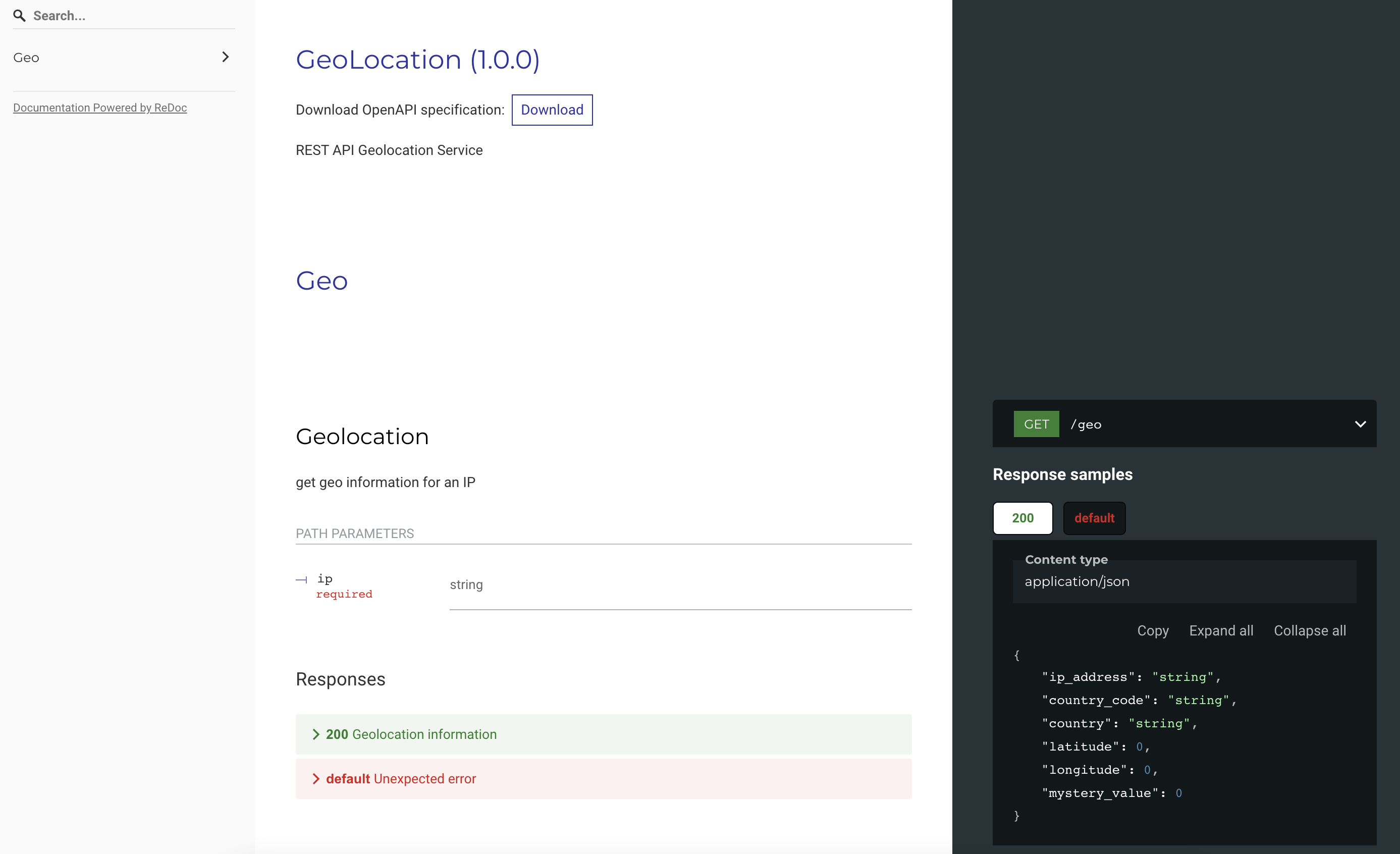
To check if the webservice is running, call this utl in a browser (http://127.0.0.1:3000). Note: Make sure the port 3000 is already free in the hosting environment.
-
 This is the swagger documentation of the webservice.
In this page you can also download the swagger file.
GET http://localhost:3000/api/v1/geo/1.2.3.4
Response:
{
  "City": {
    "GeoNameID": 0,
    "Names": null
  },
  "Continent": {
    "Code": "OC",
    "GeoNameID": 6255151,
    "Names": {
      "de": "Ozeanien",
      "en": "Oceania",
      "es": "Oceanía",
      "fr": "Océanie",
      "ja": "オセアニア",
      "pt-BR": "Oceania",
      "ru": "Океания",
      "zh-CN": "大洋洲"
    }
  },
  "Country": {
    "GeoNameID": 2077456,
    "IsInEuropeanUnion": false,
    "IsoCode": "AU",
    "Names": {
      "de": "Australien",
      "en": "Australia",
      "es": "Australia",
      "fr": "Australie",
      "ja": "オーストラリア",
      "pt-BR": "Austrália",
      "ru": "Австралия",
      "zh-CN": "澳大利亚"
    }
  },
  "Location": {
    "AccuracyRadius": 1000,
    "Latitude": -33.494,
    "Longitude": 143.2104,
    "MetroCode": 0,
    "TimeZone": "Australia/Sydney"
  },
  "Postal": {
    "Code": ""
  },
  "RegisteredCountry": {
    "GeoNameID": 2077456,
    "IsInEuropeanUnion": false,
    "IsoCode": "AU",
    "Names": {
      "de": "Australien",
      "en": "Australia",
      "es": "Australia",
      "fr": "Australie",
      "ja": "オーストラリア",
      "pt-BR": "Austrália",
      "ru": "Австралия",
      "zh-CN": "澳大利亚"
    }
  },
  "RepresentedCountry": {
    "GeoNameID": 0,
    "IsInEuropeanUnion": false,
    "IsoCode": "",
    "Names": null,
    "Type": ""
  },
  "Subdivisions": null,
  "Traits": {
    "IsAnonymousProxy": false,
    "IsSatelliteProvider": false
  }
}- geoip-golang (https://github.com/oschwald/geoip2-golang)
To read from geoip db file.
Viper is a complete configuration solution for Go applications including 12-Factor apps. It is designed to work within an application, and can handle all types of configuration needs and formats.
GeoLite2: This product includes GeoLite2 data created by MaxMind, available from https://www.maxmind.com