Skip to content

slazav/alos_overlay

Folders and files

NameName
Last commit message
Last commit date

Latest commit


History

23 Commits


Repository files navigation

alos_overlay -- fixing ALOS DEM data

I'm using ALOS DEM data for my mountain maps ( https://slazav.xyz/maps/hr.htm ).

Unforunately, they have quite many data artefacts in some regions. Here I'm fixing ALOS V4.1 data by cutting holes manually (see png masks) and filling them by some other data (ASTER DEM V3).

Result is published as *.png mask files and *.ovl files with fixed data.

Format of *.ovl files is simple: it's a binary file with a sequence of records, one for each fixed point. Each record contains three int16_t numbers: x,y,z.

I'm using libraries from mapsoft2 project ( https://github.com/slazav/mapsoft2 ) ovl files can be used there to have access to the fixed data.

Example

Pamir mountains (part of N38E072), original and fixed data:
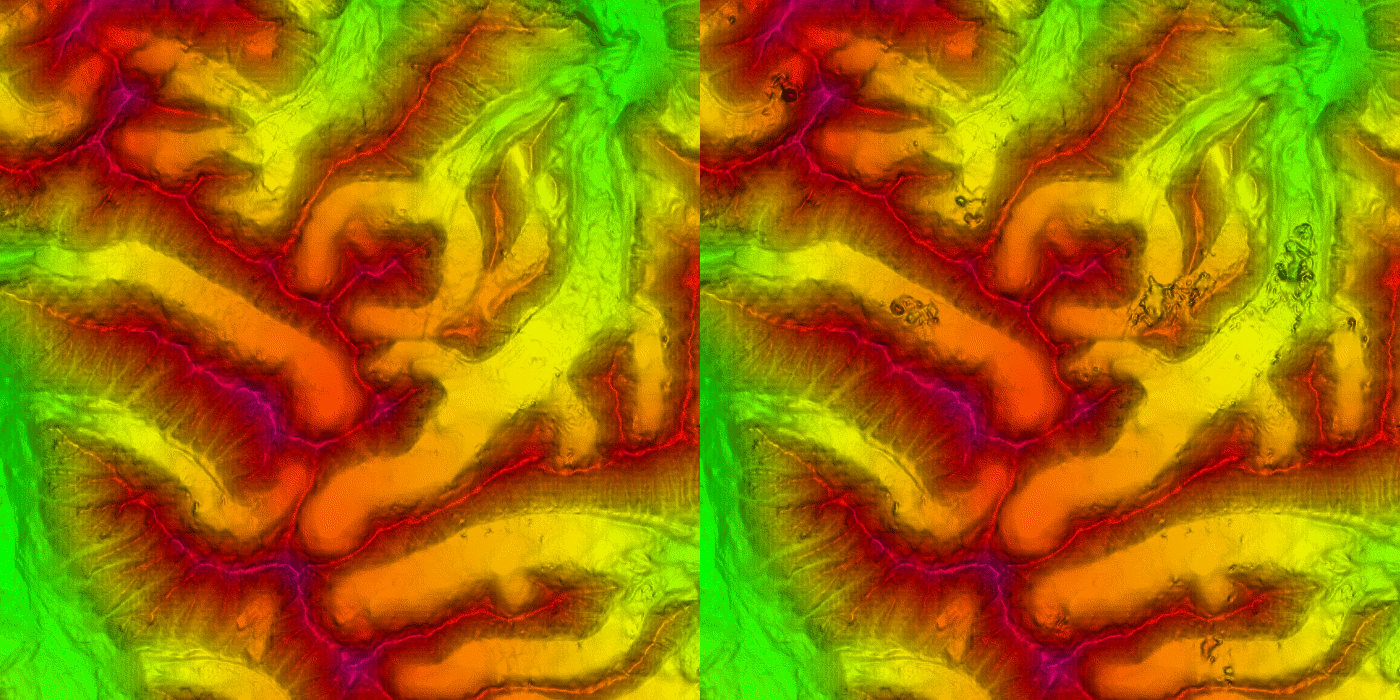
example 1

About

fixing ALOS DEM data

Resources

Stars

Watchers

Forks

Releases

No releases published

Packages

No packages published