Meeting 2025 01 07 (Technical Group)
Time: 13:30 - 15:00 Place: Online
Coordination: Arnaud Poncet-Montanges (Technical Group Secretary) (APM)
Present:
- Urs Kaufmann (Holinger Thun) (UK), Stefan Burckhardt, Lukas Wiss (geowerkstatt), Sandro Gassmann (geopoint lütolf AG) (SG), Timothée Produit (Alpnetsystem SA (ig-group)) (TP), Jean-Pierre Dupuy (Morges) (JD), Marion Nappez (GeoConseils SA) (MN)
- Welcome to Marion Nappez from Geoconseils SA
- Protocol of December meeting was illustrated with images of results achieved in 2024. and some of these are also posted on www.teksi.ch
- Newsletter was sent out with overview of results achieved in 2024
The technical group members share their goals for this year:
In 2025 we aim to ...
- Meet once every month to
- Discuss and tackle technical issues regarding TEKSI Modules and QGIS
- Exchange ideas and improvements for TEKSI Modules and QGIS
- Data in water distribution - SVGW / SSIG Technical day november 2023 - basis for TEKSI water developments - expected for 2025 / 2026
- qwat maintenance as end of life is delayed to end of 2026.
- Ease release process and code integration (CI) 9A project (AP)
- Migrate from qgep to tww (Pully, Holinger, geoconseils, ig group, geopoint lütolf)
- New datamodel tool (9B)
- New TEKSI INTERLIS Tools (TIT) - 9C
- Batch export INTERLIS from tww to geoportal (geopoint lütolf) - needs re-implementation of batch export (as was available in qgepqwat2ili)
- Integrate new data models Protection tube and Control cables in qwat, tww and tdh
- Use VSA-DSS and VSA-KEK classes and new features such as linear referencing
- First release of TEKSI District Heating (Morges)
- Export SIRE and History Viewer integration on qwat / tww (geoconseils)
- Migration Geonis to twww (Morges)
- Support construction permit process with QGIS and geocity application (Morges)
- Integrate qfield for communities with modules tww / qgep (ig group)
- 9A/B/C Project : Tools and processes for installing, managing and updating TEKSI modules - next presentations 8.1 and 16.1. (to steering commitee)
New LTR ahead: 3.40
These new features might be of interest for TEKSI modules
-
Feature: Add “Linear Referencing” symbol layer type - interesting new feature to visualize channel damages from VSA-KEK import on reach (since (3.40)

-
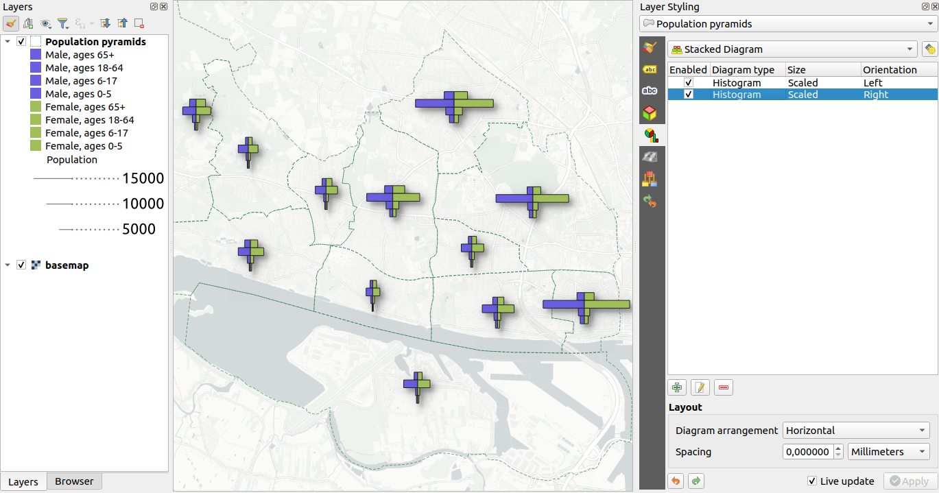
Feature: Introduce stacked diagrams - e.g. to display public and private length of sewer system per community (since (3.40)
-
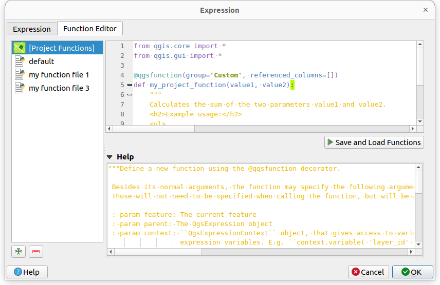
Feature: Allow users to save expression functions in QGIS project file - to discuss if this would facilitate certain things. (since (3.40)
-
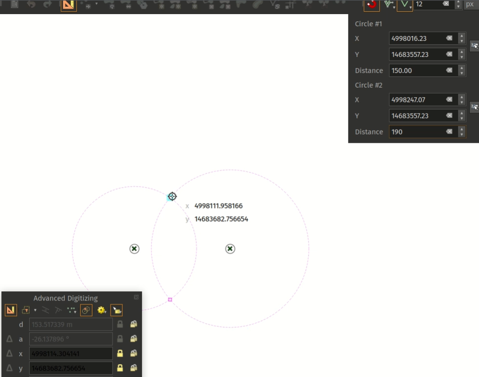
Feature: Add circles intersection digitizing tool - supports now construction of points with two measure
-
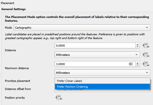
Feature: Add maximum distance setting for point labels - might be used to improve placement of labels (since (3.38)
-
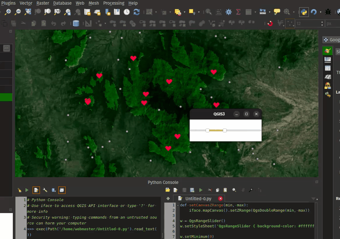
Feature: Add z range filter option for layout maps - could allow to easily find out if canalisation is in the groundwater or not (since (3.38)
- see also Feature: Add @map_z_range variables reflecting the map’s z range values
-
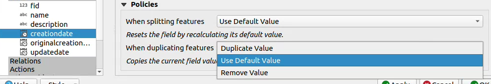
Feature: Duplicate policy on fields when duplicating features - to better specify if an attribute should be copied or not when beeing duplicated (e.g. when cutting reaches - see https://github.com/teksi/wastewater/issues/422) (since (3.38)
-
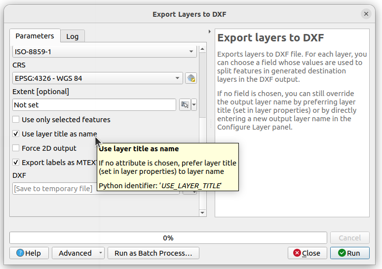
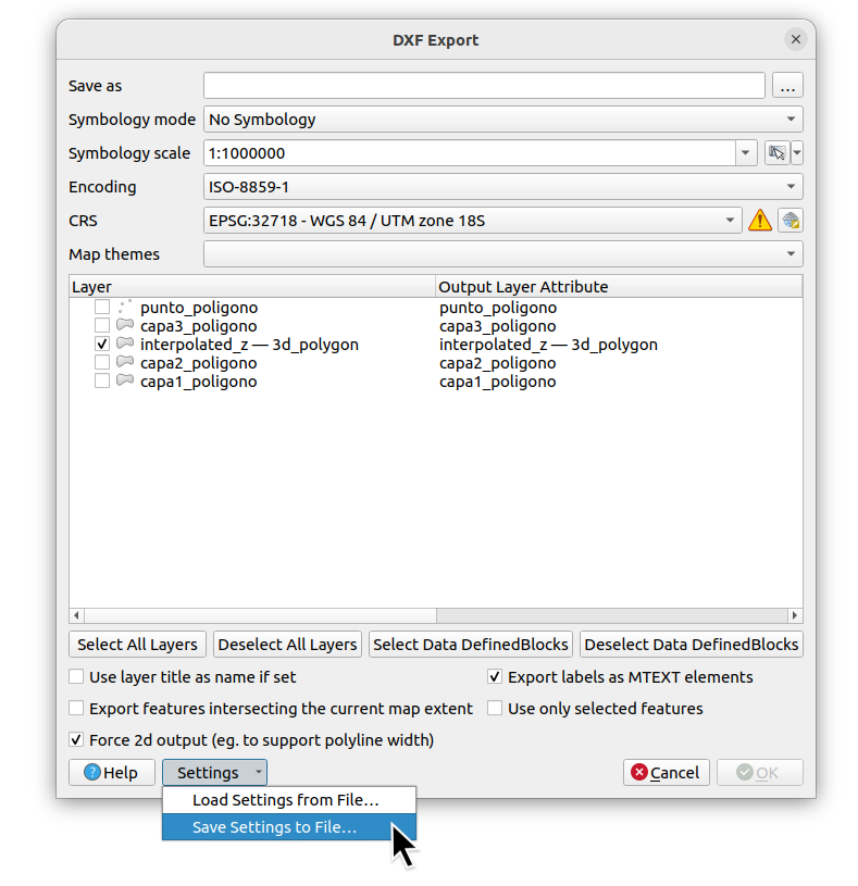
Feature: Allow users to override the layer names exported to DXF - sponsored by QGIS Switzerland (initiated by Urs(?))
- [Feature: Add option ‘Use only selected features’ to DXF export ¶](https://www.qgis.org/project/visual-changelogs/visualchangelog338/#feature-add-option-use-only-selected-features-to-dxf-export) - now selection is also supported with dxf export!
-
Feature: Import/ Export ‘DXF Export’ dialog settings - and saving Import / Export settings is now also implemented! All features sponsored by QGIS Switzerland
- Feature: Improved Export Layers to DXF algorithm - and more options (already since (3.36)
-
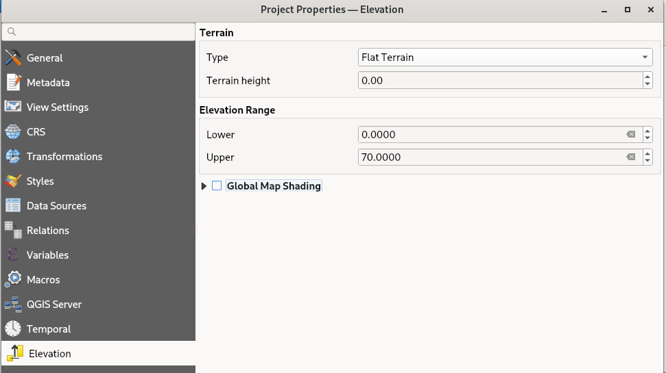
Feature: Add elevation range to project properties - project definition of elevation range - easy way to secure that z values are within z range of community (since (3.38)
- Feature: Python support in Qt6 builds - QGIS 3.36 brings support for running Python under Qt 6 builds, and enables use of the PyQGIS library within Qt 6. This is a significant milestone in our ongoing journey towards full support for Qt 6! - see also end of life qt5 Discussion
-
Order entries in value relation widget

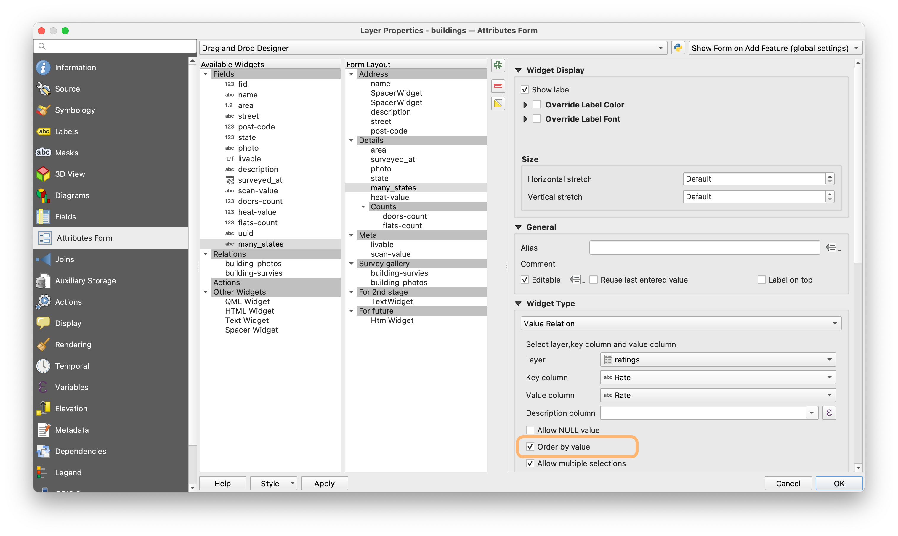
- adding descriptions and an extra display value (that includes special characters and spaces) de, fr, en, it to value list tables and dictionary tables
Next meetings:
- Q & A Migration 22.1. 9:00 -10:00 - SB will send out invitation with link to workshop slides from User Day 2024.
- February 11th, 2025 13:30 - 15:00
- Q & A Migration 25.2 13:30 - 14:30
- Save the date: Journée Romand de la geoinformation 13.11.2025 - TEKSI will be present in some forms (booth, maybe talk - see call for proposals)
